Oramel Land Swap
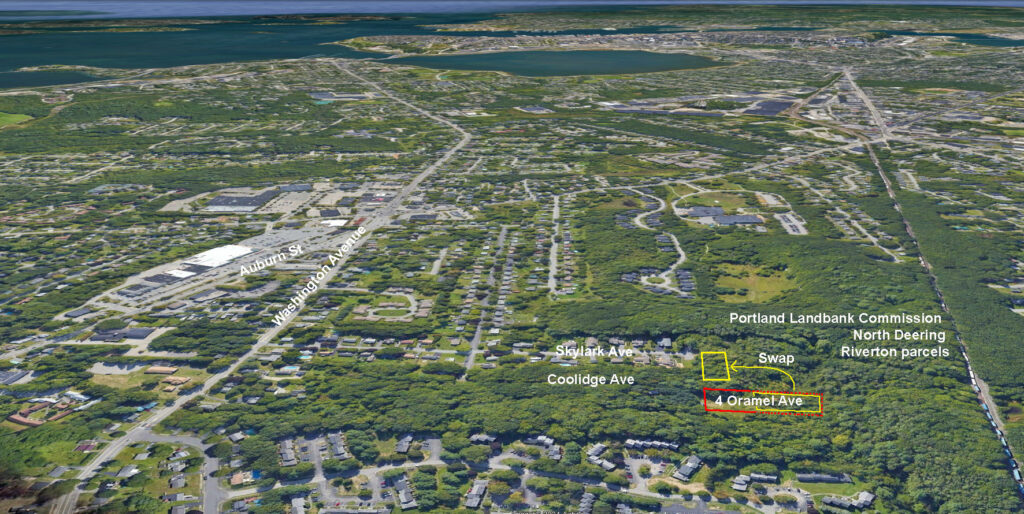
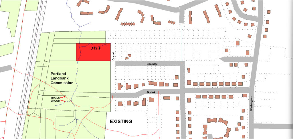
Davis van Bakergem purchased 4 Oramel Avenue on Jaunary 8, 2024 (IAS_PARCEL_ID 349 D006001) which consists of 14 50x85ft parcels (1.36 acres) at the end of Coolidge Avenue. The lot is surrounded on three sides by the Portland Landbank Commission North Deering/Riverton parcels.
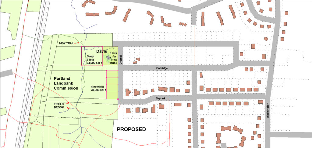
Davis proposes a land swap of eight parcels (34,000 sq ft) for the equivalent of four parcels (30,000 sq ft) owned by the City of Portland and managed by the Portland Landbank Commission. The eight parcels owned by Davis are unbuildable due to topography, stream setbacks, flood zone and flow-way boundaries. The four potential parcels owned by the City touch Oramel Avenue (paper street) and are not burdened by environmental constraints. Within a few years, it’s likely that sewer and water will be present in Oramel and the potential four parcels will be conforming, buildable lots. Davis proposes a one for one no-cost swap.

Objectives
Davis van Bakergem
- Build a single family house at 4 Oramel Avenue with protected views to the west;
- Connect the new house to the future City water and sewer (currently, well & septic);
- Control the design & construction quality of future development to the south;
- Enhance our reputation as developers of high quality residential projects in Portland;
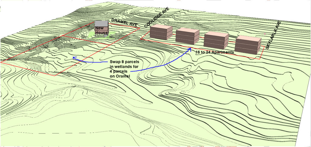
- Build 16 to 24 multifamily units on 4 new parcels on Oramel Ave (some or all affordable);
- Maintain the new rental units for a long term hold (explore cooperative ownership options).
City of Portland and Portland Landbank Commission
- Increase the inventory of affordable housing in the City of Portland;
- Utilize City owned property for affordable housing while not reducing net public green space;
- Protect the forest cover and tree canopy for new housing developments;
- Achieve a more coherent geometry for the Landbank area;
- Maintain and enhance amenities in the North Deering / Riverton Parcels (new trail by Davis).
Location and Site Plans
To view this area in Google Earth or Bing, search for 40 Coolidge Avenue, Portland, ME
Compare existing and proposed parcel ownership below.

The swap would enable a new loop trail to be developed along the brook in the gulch. A better configuration for the urban design qualities of the new neighborhood could be achieved.

The sketch below is an early draft of the new house location and the 16 to 24 apartment units. The sketch is a simple massing diagram and not a representation of any architectural decisions.

The essential question: Is this land swap even remotely feasible? Seeking yes/maybe/no feedback.
I plan to contact the following people:
Kate Sykes, District 5 Councilwoman
Ethan Hipple, Director, Parks, Recreation and Facilities Management
Greg Watson, Director, Housing & Economic Development Department
Pat Bailey, Chair, Land Bank Commission
Davis van Bakergem
(314) 529-9068